



Darwin Braces for Destructive Winds as Cyclone Fina Strikes
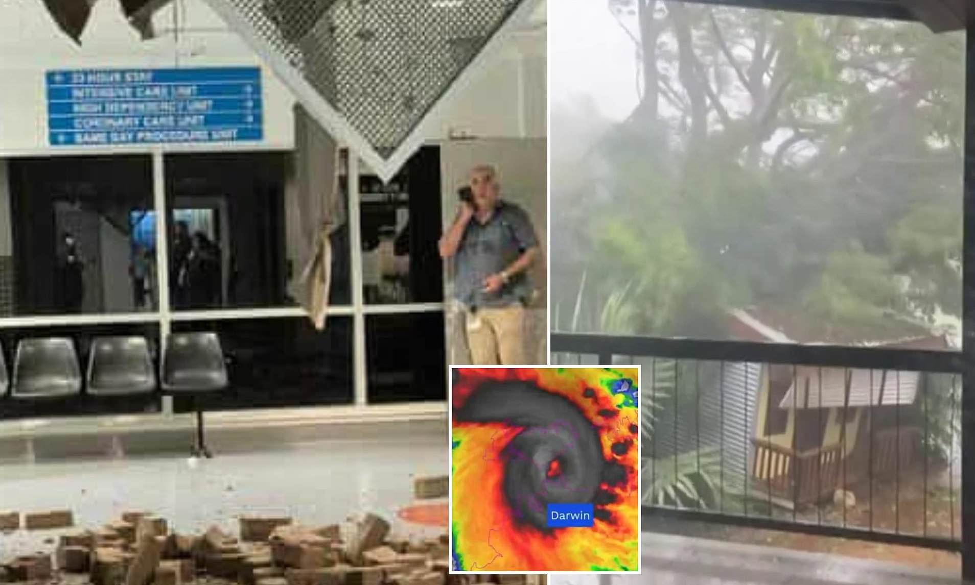
Darwin has faced a severe onslaught from destructive winds reaching up to 205km/h, marking the most powerful storm to hit the Top End since the devastating Cyclone Tracy half a century ago. This cyclone has caused significant damage, with roofs ripped off and a section of the city’s major hospital roof torn apart.
Severe Tropical Cyclone Fina passed the coast as a category three system overnight, leaving a trail of destruction as it moves west into the ocean. While there are currently no reports of injuries, power outages continue across the city. A portion of the roof at the Royal Darwin Hospital has collapsed, with reports of water inside the building.

Emergency authorities have advised residents in Darwin and surrounding areas to remain indoors or seek shelter until the all-clear is given. 
Impact on Remote Communities
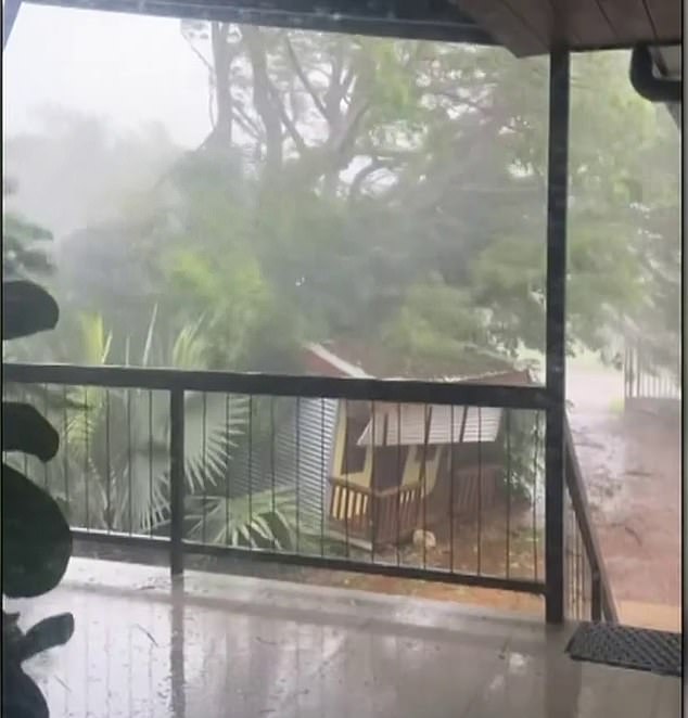
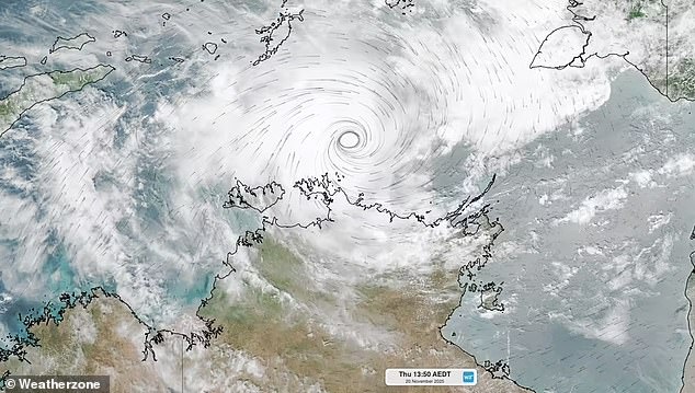
Category three Fina brought destructive winds and heavy downpours to remote Tiwi Islands communities, followed by Darwin and surrounding areas on Saturday and into Sunday. Forecasters now have Fina tracking just north of Darwin. NT Police incident controller Kirsten Engels urged residents to stay at home, but the sweeping sheets of rain and high wind gusts kept most people indoors.
Emergency shelters are open in Darwin, nearby Palmerston, and adjacent rural areas, with evacuees encouraged to bring their own bedding and food. Extraordinary videos shared online have shown the cyclone’s destructive power, including a powerline being ripped apart and a small explosion of sparks. 
Response and Recovery Efforts
Powerful winds have also led to trees falling across the city. Australian Defence Force personnel are on standby to assist with clean-up efforts, and financial assistance will be available to support local governments and communities during recovery.
Fina is the Northern Territory’s strongest cyclone to pass Darwin since Cyclone Tracy on Christmas Day 1974, which claimed 66 lives and devastated the city, forcing thousands to relocate. The system was more powerful than Cyclone Marcus, which passed Darwin as a category two in 2018. 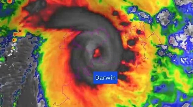
Future Outlook
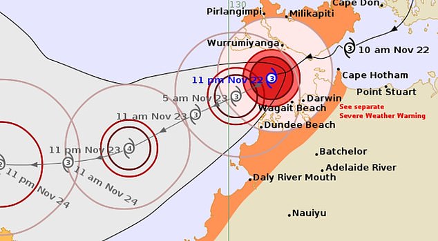
Now tracking west-south-west, Fina is gaining strength over the Timor Sea and could potentially hit the top of Western Australia in the coming days. A cyclone warning remains in place from Wadeye to Cape Hotham, including Tiwi Islands, Dundee Beach, Darwin, Milikapiti, Pirlangimpi, and Wurrumiyanga, with a watch zone active from Wadeye in the NT to Troughton Island and Kalumburu in WA.
According to the Bureau of Meteorology’s latest update, the system is expected to reach category four strength sooner than anticipated. BOM senior meteorologist Angus Hines warned that more heavy rain and strong winds are forecast for Darwin on Sunday.
‘There are still bands of rain and strong winds on the outer edges of this tropical cyclone, which are very likely to impact the Darwin area and other parts of the northern and western Top End of the Northern Territory throughout the day,’ he said. ‘This will be a little bit different to Saturday, where the rainfall was persistent and ongoing.’
Weather Conditions
‘On Sunday it will come through in waves, as a band crosses overhead, and then there’ll be some gaps of drier weather in between. It will still be very windy today … and we could see damaging wind gusts once again across Darwin.’ Conditions are forecast to ease later on Sunday.
Cyclone Fina is expected to weaken near the Kimberley coast on Tuesday or Wednesday. As the storm continues its path, the community remains on high alert, preparing for potential challenges ahead.

